
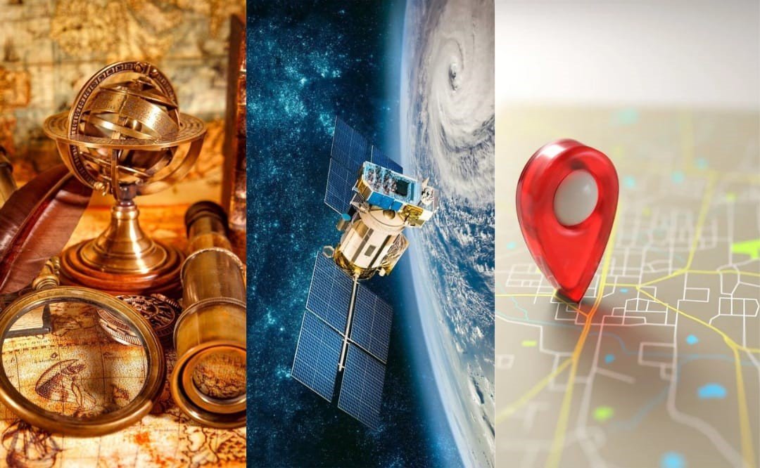
Global navigation systems, modern-day lighthouses and their Asian moons
Tarek Al-Masri
The geolocation service has become one of the necessary technical axioms in our time, as we have become dependent on it in most of our devices and means of transportation, which has saved us time and money by avoiding traffic jams that have become a reality in most cities, and despite its tremendous impact on us, it is not compared to its strategic impact on large and giant institutions and companies, many of which were established on the idea of having such a service, but governments have given it the greatest attention, as a strategic, military and technical superiority tool, a developmental and economic support, and an integration tool with growing AI systems, especially in countries that seek prosperity.
"The broader the vision, the greater the control"
Idea and history
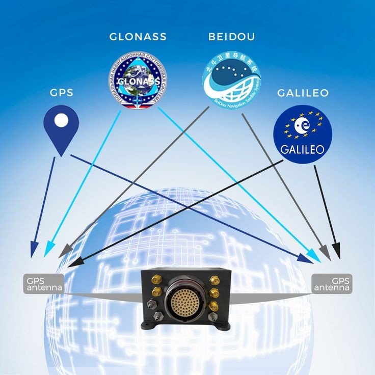
Satellites are the backbone of Global Navigation Systems Services (GNSS), the generic name for global navigation networks, and although these satellites were originally a service for military purposes, today they provide these services to civilians and commercial companies, this duality has grown and developed due to the characteristics associated between navigation systems and technological sectors, but the most prominent reason that led to the availability of these military systems for civilian use was the incident of shooting down the Korean plane in 1983, after it lost its way as a result of a navigation error, violating the restricted area of the Soviet Union's airspace, which led to its downing, as a military target.
Many view the American GPS network as the unprecedented American superiority of navigation systems, but the biggest contributor to this was the Soviet Union, when they launched their "Sputnik" probe in 1957 into space, which made the Americans receive and study the transmitted signals, and based on the Doppler effect. and its deviation, they knew their location on Earth, so inspiration came to the Americans, and they initiated the creation of the first system of global navigation network systems, to be completed in 1994 with the launch of the last of its 24 satellites within the orbits assigned to them, under the name of the Global Navigation System GPS, whose system is still being developed periodically, with its constellation of 31 satellites.
However, the primacy of the United States with this privilege made competitors realize the importance of accelerating the acquisition of a positioning system similar to the American GPS system, as the Soviet Union had a head start before the Americans when they made the first proposal to use satellites for navigation in 1957 AD, but the first launch of their satellite was delayed until 1967 AD, and with it the official announcement of the operation of their navigation system was delayed until 1993 AD, known as "GLONASS." The Russian interest in navigation systems increased due to the military services provided by GPS in the first Gulf War, which some consider the "first space war," the launch of satellites and space devices for the Russian navigation system continued until it reached 24 satellites in 1995. Satellites and space devices for the Russian navigation system continued to be launched until their number reached 24 satellites in 1995, after which funding for the project stopped due to the difficult economic conditions in Russia at the time, and then the number of operational satellites decreased in 2001 to only 6 operational satellites, but in August of the same year, the Russian government decided to refinance the project with a budget estimated at one third of the Russian Space Agency budget at the time, and launched the necessary number of satellites of the latest generation, to cover the entire area of Russia by 2008 AD, then the global field in 2011 AD with its 26 satellites in orbit.
Other countries would not have overlooked the merit of these systems, as the European Union went far from military purposes, as it built its system from the ground up to be an independent European system under civilian control, a direct contrast to the American GPS system run by the US Department of Defense, called "Galileo" after the Italian scientist Galileo, where the first satellites were launched in 2011 through the European Agency for Navigation Systems, which became considered more reliable in urban environments, more powerful with its own encryption system, and legitimized for authorized users in European Union countries, with a constellation of 26 satellites.
The Asian ambitions represented by China, India and Japan could not overlook the importance of these systems, and sought to build systems similar to those systems. The Chinese government anticipated them, through cooperation and partnership with the Russian government in the process of building a regional navigation system covering China and South Asia, which it called BeiDou.) In the late 1990s, to reduce the military's dependence on the Global Positioning System (GPS) made by the United States, especially when China lost control of some of its missiles launched at sea, after it cut off the tracking service from the GPS navigation system, China considered it as a warning and a great motivation for China to own its own navigation system, so in 2000, it launched the first satellites to cover China regionally, then the Asia-Pacific region in 2012, and then the Asia-Pacific region in 2012 2012, then adopted a vital plan to develop and operate the system as a critical national project, followed by the launch of the latest generation of satellites, which amounted to 30 satellites by 2020, and Beidou became a global navigation system, and China achieved global leadership on May 16, 2023, when it launched its latest satellites to renew the planet, which amounted to 56 satellites, almost twice the number of US GPS satellites.
Japan was one of the countries aspiring to build its own system, one year behind China, when it launched its first satellite in 2001 from its system called QZSS, a system of four satellites that provides regional communication services and positioning information for the mobile environment, as this system was focused on the region of Japan, but it now provides service to the region of Asia, Oceania, and the oceans between them, and because it works in an integrated manner with the (GPS) system, it is sometimes called the (Japanese GPS) system. Because it works in an integrated manner with the GPS system, QZSS is sometimes called the Japanese GPS system, and because of this reliance, it guarantees a sufficient number of satellites for stable and high-precision positioning, and Japan plans to expand its system to seven satellites by 2024.
India, which is experiencing escalating economic growth, was not far from the importance of these systems and the civil and military investment it aspires to, so it built its NavIC system, which has been fully operational since 2018, through seven satellites for navigation purposes and only one satellite for messaging purposes, covering the entire Indian subcontinent, expanding it west to include Saudi Arabia, north and east to include all of China, and south to include both Mozambique and Western Australia and the water bodies between them.
Among the countries aspiring to build their own navigation system in the future, Turkey was technically ahead of the United Kingdom by a large difference. Britain, which separated from the European Union, found itself forced to build its system, which felt after its separation that it would be weaker in many ways without enjoying a Galileo-like system, after restricting its powers to manage the European system, as it is expected that the United Kingdom will finish building its global service system similar to other systems in the coming years, which is believed to bear the name of Sir Isaac Newton.
Turkey seeks, in addition to its own reasons, and in an effort to complement its strength, to build its own system away from the need to use the available systems due to their lack of confidence expressed by its official, in the United States and other countries, and their fear of depriving them of navigational services when they need it most, so their project is newly established with its initial structure and existing ground stations through a consortium of five local Turkish companies, which is believed to be available at the end of 2030 or in the coming years, for Turkey to achieve salvation from foreign dependence with its system called "TRNAV".
Current status
Our skies are currently covered by six global navigation systems (GNSS), and the similarity between them is great, but the main difference between navigation systems lies in the scope of coverage, and several criteria are added to them, such as accuracy, sustainability and the cost associated with their use, and hence these systems have become a new field of competition between great powers, but China stands out among them in particular, through its Beidou system satellites, as a means to enhance its diplomatic, economic and military power, as its system services are exported to support the Belt and Road Initiative and the Digital Silk Road initiative, its system, which consists of a large number of satellites and distributed observation stations, is superior to other systems, as a result of which China provides accurate information in the fields of navigation and timing, with the advantage of two-way communication in areas that lack GNSS coverage. As a result, China provides highly accurate information in the fields of navigation and timing, with the advantage of two-way messaging in areas that lack terrestrial network coverage, and can be used in search and rescue operations, a feature not available in other systems, especially in the developing world and the Global South, as China works to encourage other countries to use Beidou signals and acquire its specialized equipment due to its advanced and modern technologies, so that most leaders of the developing world find it difficult to reject these infrastructures It is difficult to reject these infrastructures and the economic opportunities offered by China, despite their awareness that linking this infrastructure with Chinese signals may give China a great influence on their technological future, or control the economy of their countries as an economic and developmental dependency, because Chinese technology packages include a hierarchy, bifurcation and technology associated with future development projects, making China an essential partner for countries that seek to link with continuous technological progress, so China's competitors must prepare to compete effectively and thoroughly, because the establishment of these services originally came to achieve military superiority associated with the control of the nuclear triad that
Many economic and commercial facilities would not have reached the level of accuracy, ease and speed in performance without the availability of this service, which has become a pillar of many economic fields for the countries that own them, and for the countries that rent this service, as the value of the global navigation systems market in 2022 amounted to 36.3 billion US dollars and is expected to record a compound annual growth rate of 9.84%, reaching 64.6 billion US dollars during the forecast period extending to 2030 AD, and is expected to record a CAGR of 9.84%.
Dangers and disadvantages
The increase in our dependence on global navigation systems does not leave it as a flawless value, but these flaws are not in the system itself, but in the consequences of losing this service, similar to the effects of the Covid-19 pandemic, but technical, as Britain estimated that its losses may reach 5.1 billion pounds sterling, for every five days of disruption of this service, while the United States of America estimated its losses at about one million US dollars per day, and the interruption of this service is a matter of occurrence, whether due to human and technical errors, or unintentional or contrived jamming operations, or perhaps due to natural phenomena, as it is a frequent and frequent matter with varying degrees of severity, as navigation systems have been affected on several occasions, whether due to security jamming operations, especially during the movement of some heads of state, or in cases of outbreaks of conflicts and escalating tensions with countries owning these systems or their allies, as currently happening in Lebanon and
However, the greatest danger to these systems does not lie in jamming operations as much as in military operations that always threaten to bring down these systems operating in space by destroying them with space defense systems, and is not criminalized by the Space Convention, which prevents the use of space as an arena for armament and a field in which weapons swim above us, but some earth experts expect that this danger is small and cannot be the size of the greater damage that may be caused by a solar storm, as a solar storm is no less dangerous than a military attack. Natural disasters are no less dangerous than a military attack in this regard, as a massive solar storm similar to the Carrington incident that occurred in 1859 would be capable of destroying the network of military and civilian satellites, including global navigation satellites, and the space stations located above us, which number 11,330 satellites as of the preparation of this study, and by crashing, they would set us back decades, causing us technical blindness on land, sky and high seas.
Conclusion
GNSS is an essential part of global technological development and contributes to maintaining safety and stability and promotes economic and commercial improvement and scientific discovery, and has provided us with a new dimension, facilitating mobility and transportation, shortening our time, and contributing to the transformation of our world to a new stage in control and control at the level of people, companies and governments, and if not for the Korean plane incident, this service would not have been available to us and remained for the benefit of military institutions.
Although the Soviet Union was ahead of the USSR in thinking and preparing to build these military systems, the Americans preceded them in building their system, and were later followed by the European Union with a complete civilian system, leading the Asian countries that seek leadership in the fields of contemporary development with the number and features of the systems they built, especially the Beidou system built by China, which placed it at the forefront of the leading countries in providing this service globally, and with its superiority opened the field for competition among countries capable of building the most capable, modern, and efficient system.
Despite the development of our world with its current technologies and systems, it leaves in our imagination a reality that is difficult to imagine once we lose global navigation systems, or they are damaged, as a result of intentional or unintentional jamming operations, especially if they are considered strategic targets in the expected world wars, or a solar storm that carries with its waves a reality that brings us back to years of backwardness and technological blindness, and keeps us wondering about our ability to live without navigation services, which have become beacons of guidance to the modern world and what we possess of devices and equipment for communication and transportation.
Studies and Research section of the forum


